Scope of Work:
GPR survey execution for mapping underground utilities to design proposed underpass preventing the damage to pre-existing assets.
Location:
Ahmedabad, Gujarat, India.
Client:
Ahmedabad University
Equipment:
GSSI SIR-3000 equipped with 200 MHz and 400 MHz antenna
Summary:
The GPR survey has been carried out at two proposed underpass locations at Navrangpura
area (commerce Six Road) between campuses of Ahmedabad University. The total area
scanned is approximately 1400m2 in 3 patches on 2 different major roads. The scope of work
includes the mapping of possible underground utilities upto the depth of around 6-7 m using
non-destructive Ground Penetrating Radar technology. The purpose of the project is to
plan the proper execution of proposed underpass project and prevent the damage of existing
underground utilities during the execution. Considering the client’s requirements and the expected
depth of the utilities, the area has been surveyed using 200 MHz and 400 MHz center
frequency antennas mounted with SIR 3000 GPR system to cover the depth upto 6-7 m with
fair resolution. The purpose of the survey was to
map all the underground utilities viz. cables, water lines, gas lines, sewer line etc. upto the
depth of 6-7 m using non-destructive technology. The whole data is collected in three patches
of two different major roads. Numerous parallel profiles have been collected across the width
as well as along the length of the road at a spacing of 1 m and some extra profiles across the
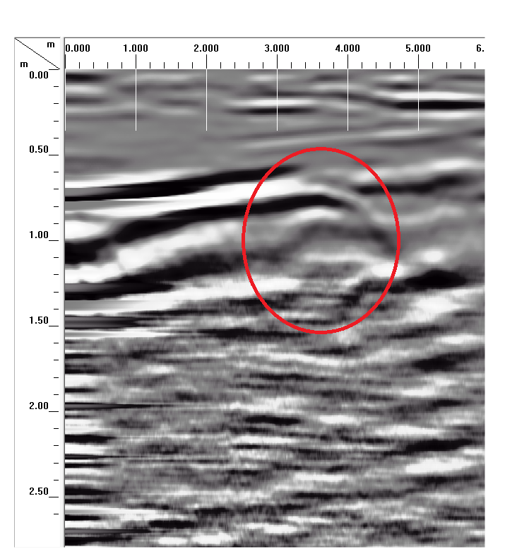
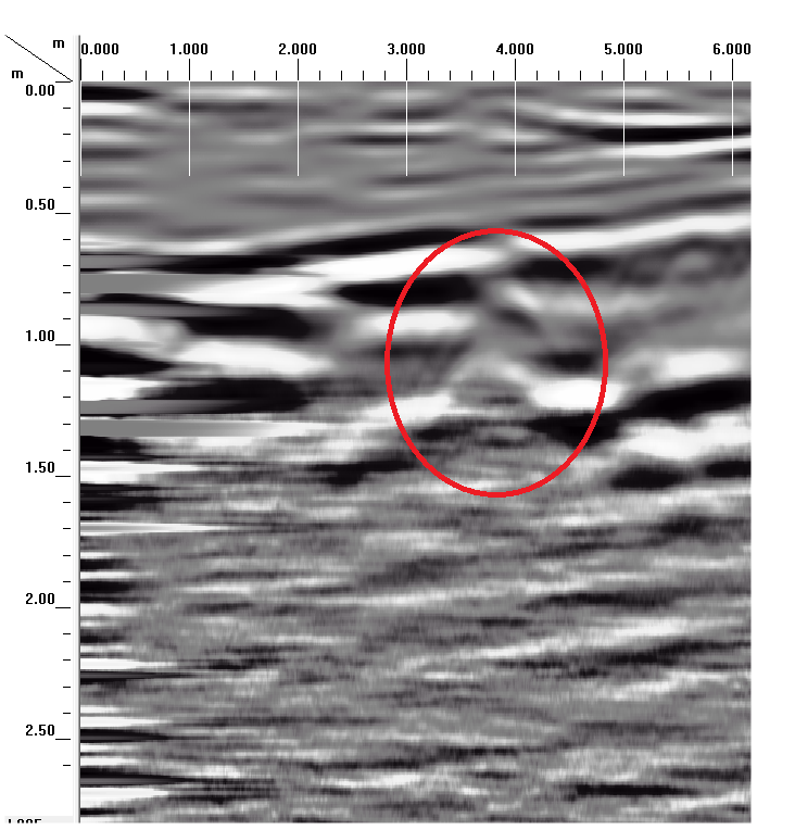
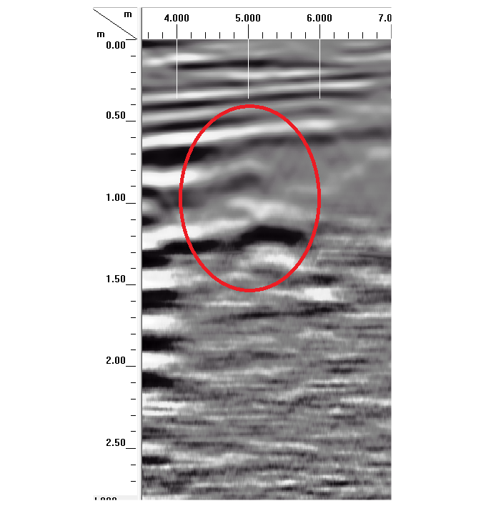
road at 2 m and 5 m spacing on either side of the scanned areas. Overall five utilities are observed along the road at first proposed underpass location.
No utility has been found to exist in across the road direction at first site
Total twelve utilities have been observed at second proposed site in
longitudinal direction. Most of the utilities are found to be at an average depth of 0.5-0.9 m.
However, no utility is found to exist at a depth greater than 1.5m.