Scope of Work:
Underground utility mapping using GPR technology at proposed flyover location at Ajit Mill circle in Ahmedabad
Location:
Ahmedabad, Gujarat, India.
Client:
Ahmedabad Muncipal Corporation.
Equipment:
GSSI SIR-3000 equipped with 200 MHz and 400 MHz antenna
Challenges:
Heavy traffic on road
Summary:
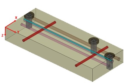
The GPR survey has been carried out on an area of about 14700m2 at Ajit mill circle along Lal
Bahadur Shastri road upto a length of 700 m X 21 m. The scope of work includes the mapping
of all possible underground utilities upto the depth of 6 m using non-destructive Ground
Penetrating Radar technology. The purpose of the project was to prevent the damage to the
to the existing utilities during the construction phase of proposed yover bridge. The purpose of the survey was to map all the underground utilities viz. cables,
water lines, gas lines, sewer line etc. upto the depth of 5-6 m using non-destructive technology.
The area is along the Lal Bahadur Shastri road across the Ajit Mill circle. The whole data is
collected in four patches, each of dimension 350 m X 10.5 m. Numerous parallel profiles have
been collected across the width as well as along the length at an spacing of 6 m and 2.5 m
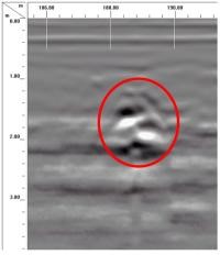
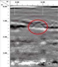
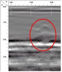
respectively. Over all around 7 pipelines along the road and 8 pipelines or utilities across the road
could be interpreted on the basis of repeating impressions. Numerous manholes are mapped, exposed as well as buried and are marked in the final
drawing.
At some locations, different high reflections were observed and there is a possibility of these
reections to be joints or similar feature.